Category:Danehill, East Sussex
Jump to navigation
Jump to search
village and civil parish in East Sussex, UK  | |||||
| Upload media | |||||
| Instance of | |||||
|---|---|---|---|---|---|
| Location | Wealden, East Sussex, South East England, England | ||||
| Area |
| ||||
 | |||||
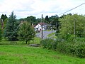
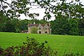
English: Danehill (also known as Dane Hill) is a village and civil parish in the Wealden District of East Sussex, England. The village is located five miles (8 km) north-east of Haywards Heath and on the edge of the Ashdown Forest. Other places within the parish include the village of Chelwood Gate and the hamlets of Furner's Green and Twyford.
Subcategories
This category has the following 7 subcategories, out of 7 total.
A
- Ashdown Llama Park (12 F)
C
D
- All Saints Church, Danehill (42 F)
- Danehill War Memorial (3 F)
F
- Furner's Green (3 F)
O
- Oasts in Danehill (6 F)
Z
Media in category "Danehill, East Sussex"
The following 200 files are in this category, out of 487 total.
(previous page) (next page)-

-
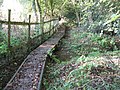
 A footbridge across a bridleway - geograph.org.uk - 2062371.jpg 640 × 480; 223 KB
-
 A view SW across part of Ashdown Forest - geograph.org.uk - 2060460.jpg 640 × 480; 146 KB
-
 A wet and windy day, Ashdown Forest - geograph.org.uk - 4105989.jpg 428 × 640; 133 KB
-
 A woodland path in Ashdown Forest - geograph.org.uk - 5405922.jpg 4,000 × 3,000; 4.72 MB
-
 A22 NW to Wych Cross - geograph.org.uk - 3561314.jpg 3,264 × 2,448; 4.85 MB
-
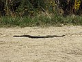 Adder sunning itself on track - geograph.org.uk - 2062492.jpg 640 × 480; 175 KB
-
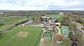
 Aerial view near Chelwood Gate - geograph.org.uk - 5948782.jpg 1,352 × 693; 165 KB
-
 All Saints, Danehill, churchyard (i) - geograph.org.uk - 4980629.jpg 640 × 480; 65 KB
-

-
-

-

-
 All Saints, Danehill, lectern - geograph.org.uk - 4981330.jpg 480 × 640; 61 KB
-
 All Saints, Danehill, lych gate - geograph.org.uk - 4980625.jpg 640 × 480; 63 KB
-
 All Saints, Danehill, memorial (i) - geograph.org.uk - 4980639.jpg 640 × 480; 77 KB
-
 All Saints, Danehill, memorial (ii) - geograph.org.uk - 4980643.jpg 640 × 480; 47 KB
-
 All Saints, Danehill, memorial (iii) - geograph.org.uk - 4980648.jpg 640 × 480; 51 KB
-
 All Saints, Danehill, memorial (iv) - geograph.org.uk - 4980649.jpg 640 × 480; 74 KB
-
 All Saints, Danehill, memorial (ix) - geograph.org.uk - 4981306.jpg 480 × 640; 58 KB
-
 All Saints, Danehill, memorial (v) - geograph.org.uk - 4980652.jpg 480 × 640; 41 KB
-
 All Saints, Danehill, memorial (vi) - geograph.org.uk - 4980653.jpg 480 × 640; 43 KB
-
 All Saints, Danehill, memorial (vii) - geograph.org.uk - 4980654.jpg 480 × 640; 45 KB
-

-
 All Saints, Danehill, memorial (x) - geograph.org.uk - 4981309.jpg 640 × 480; 75 KB
-
 All Saints, Danehill, memorial (xi) - geograph.org.uk - 4981316.jpg 640 × 480; 53 KB
-
 All Saints, Danehill, memorial (xii) - geograph.org.uk - 4981331.jpg 640 × 480; 66 KB
-

-
 All Saints, Danehill, memorial (xiv) - geograph.org.uk - 4981365.jpg 480 × 640; 54 KB
-
 All Saints, Danehill, pulpit - geograph.org.uk - 4981333.jpg 640 × 480; 68 KB
-

-

-

-

-

-
-

-
-
-

-
 All Saints, Danehill, tower - geograph.org.uk - 4980634.jpg 480 × 640; 73 KB
-
 Amanita at Danehill - geograph.org.uk - 3176293.jpg 640 × 480; 188 KB
-
 An empty Danehill Stores - geograph.org.uk - 2135424.jpg 2,592 × 1,944; 1.94 MB
-

-
 An incomplete shelter, within Lane Wood - geograph.org.uk - 2608857.jpg 1,024 × 768; 321 KB
-
 April Cottage - geograph.org.uk - 3398138.jpg 1,024 × 768; 315 KB
-
 April Cottage, Freshfield Lane - geograph.org.uk - 1950043.jpg 640 × 430; 128 KB
-

-
 Arch over bridleway - geograph.org.uk - 1530739.jpg 640 × 480; 152 KB
-
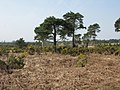
 Ashdown Forest - geograph.org.uk - 4928737.jpg 4,000 × 2,623; 1.72 MB
-
 Ashdown Forest - geograph.org.uk - 5582545.jpg 1,024 × 634; 149 KB
-
 Ashdown Forest - geograph.org.uk - 5826224.jpg 1,600 × 994; 318 KB
-
 Ashdown Forest near Chelwood Vachery - geograph.org.uk - 5308358.jpg 4,000 × 3,000; 4.62 MB
-
 Ashdown Forest near Wych Cross - geograph.org.uk - 3051969.jpg 1,600 × 1,200; 374 KB
-
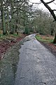
 Ashdown Forest Track - geograph.org.uk - 5826250.jpg 1,600 × 1,068; 606 KB
-
 Ashdown Forest, birchwoods and rushy heathland - geograph.org.uk - 5793902.jpg 768 × 1,024; 310 KB
-

-
 Ashdown Forest, view from A22 - geograph.org.uk - 3477780.jpg 4,320 × 3,240; 5.55 MB
-
 Ashdown Forest, winter view - geograph.org.uk - 4118721.jpg 640 × 428; 79 KB
-
 Ashdown Park Hotel - geograph.org.uk - 2959338.jpg 640 × 175; 51 KB
-
 At Danehill - geograph.org.uk - 5522172.jpg 1,024 × 852; 212 KB
-
 Autumnal trees on the edge of Wheeler's Wood - geograph.org.uk - 2130301.jpg 2,592 × 1,944; 1.64 MB
-

-
 Bamboo island in pond system - geograph.org.uk - 1530683.jpg 640 × 480; 134 KB
-
 Barn at Ashdown Llama Park - geograph.org.uk - 2957759.jpg 640 × 480; 82 KB
-
 Barn near the road - geograph.org.uk - 2893811.jpg 4,000 × 3,000; 2.18 MB
-
 Barn, Ashdown Forest Llama Park - geograph.org.uk - 3051963.jpg 1,600 × 1,194; 443 KB
-
 Barns at Ashdown Llama Park - geograph.org.uk - 2957758.jpg 640 × 480; 92 KB
-
 Beaconsfield Road - geograph.org.uk - 1981921.jpg 1,024 × 768; 326 KB
-
 Beaconsfield Road - geograph.org.uk - 5778310.jpg 1,024 × 663; 274 KB
-
 Beaconsfield Road at the junction of Lewes Road - geograph.org.uk - 4896855.jpg 2,048 × 1,536; 1.06 MB
-
 Beaconsfield Road, Chelwood Gate - geograph.org.uk - 5842479.jpg 1,024 × 768; 214 KB
-
 Bellflower Cottage - geograph.org.uk - 5828385.jpg 1,024 × 659; 219 KB
-
 Bend in road at Chelwood Corner - geograph.org.uk - 1530858.jpg 640 × 480; 129 KB
-
 Bluebell Estate Winery - geograph.org.uk - 4316185.jpg 4,000 × 2,667; 1.52 MB
-
 Bluebell Vineyard Estates - geograph.org.uk - 3358911.jpg 640 × 585; 122 KB
-
 Bovine blockage on footbridge to Sheffield Forest - geograph.org.uk - 3124258.jpg 3,264 × 2,448; 6.34 MB
-
 Box's Lane Chelwood Common - geograph.org.uk - 1778877.jpg 1,600 × 1,200; 671 KB
-
 Braberry Pond - geograph.org.uk - 2062474.jpg 640 × 480; 220 KB
-
 Bracken lined track near Millbrook Farm - geograph.org.uk - 1530627.jpg 640 × 480; 156 KB
-
 Bridge and sluice gate - geograph.org.uk - 2650719.jpg 1,600 × 1,200; 824 KB
-
 Bridge over Bridleway - geograph.org.uk - 2216208.jpg 800 × 600; 218 KB
-
 Bridge over Bridleway - Path to nowhere - geograph.org.uk - 2216212.jpg 800 × 600; 238 KB
-
 Bridleway bridge emerging from Press Ridge Warren - geograph.org.uk - 2130715.jpg 2,592 × 1,944; 2.39 MB
-
 Bridleway climbing up from ford - geograph.org.uk - 1530823.jpg 640 × 480; 143 KB
-
 Bridleway through Ashdown Forest - geograph.org.uk - 2062393.jpg 640 × 480; 193 KB
-
 Bridleway through Long Wood - geograph.org.uk - 1532160.jpg 640 × 480; 154 KB
-
 Bridleway through Mill Brook - geograph.org.uk - 2062373.jpg 640 × 480; 211 KB
-
 Brook with bridleway across it - geograph.org.uk - 2062389.jpg 480 × 640; 204 KB
-
 Brown Leghorn cockerel.jpg 3,000 × 4,000; 2.35 MB
-
 Brown Leghorn pair.jpg 3,000 × 4,000; 2.56 MB
-
 Buttercups at North Northlands farm - geograph.org.uk - 2389570.jpg 1,600 × 1,227; 686 KB
-
 Buttercups in meadow - geograph.org.uk - 1343075.jpg 640 × 480; 120 KB
-
 Car park on the A22 north of Nutley - geograph.org.uk - 4363266.jpg 1,600 × 1,016; 558 KB
-
 Cattle grazing on Ashdown Forest - geograph.org.uk - 6259244.jpg 640 × 480; 336 KB
-
 Cattle grazing on Ashdown Forest - geograph.org.uk - 6259246.jpg 640 × 480; 302 KB
-
 Cattle in Millbrook Clump - geograph.org.uk - 6194612.jpg 1,024 × 768; 597 KB
-
-
 Chelwood Common - geograph.org.uk - 5778303.jpg 1,600 × 1,005; 514 KB
-
 Chelwood Corner - geograph.org.uk - 5778315.jpg 1,024 × 663; 266 KB
-
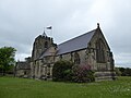
 Chelwood Gate Church, East Sussex - geograph.org.uk - 3372054.jpg 1,600 × 1,198; 587 KB
-
 Chelwood Gate Road - geograph.org.uk - 1981917.jpg 1,024 × 768; 310 KB
-
 Chelwood Gate Road, Ashdown Forest - geograph.org.uk - 5843227.jpg 1,024 × 768; 244 KB
-
 Chelwood Gate village, East Sussex - geograph.org.uk - 3334130.jpg 800 × 537; 194 KB
-
 Chelwood Vachery - geograph.org.uk - 3683444.jpg 3,072 × 2,048; 1.06 MB
-
 Chess set at Cumnor House School - geograph.org.uk - 1532105.jpg 640 × 480; 77 KB
-
 Church Lane, Danehill - geograph.org.uk - 3372053.jpg 1,600 × 1,200; 398 KB
-
 Clearing in the forest - geograph.org.uk - 2060709.jpg 640 × 480; 199 KB
-

-
 Colin Godmans Farm - geograph.org.uk - 2198248.jpg 3,264 × 2,448; 3.82 MB
-
 Collingford Lane junction with School Lane - geograph.org.uk - 1778961.jpg 1,600 × 1,200; 541 KB
-

-

-
 Concrete path sign - geograph.org.uk - 4911142.jpg 2,304 × 1,728; 807 KB
-
 Contemporary catseye - geograph.org.uk - 3398148.jpg 640 × 480; 225 KB
-
 Coppicing in King's Wood - geograph.org.uk - 1342372.jpg 640 × 480; 137 KB
-
 Cottage on Freshfield Lane - geograph.org.uk - 1950048.jpg 640 × 430; 135 KB
-
 Cottage on Freshfield Lane - geograph.org.uk - 1950078.jpg 640 × 430; 145 KB
-
 County boundary - geograph.org.uk - 3398181.jpg 1,024 × 768; 428 KB
-
 County boundary on Freshfield Lane - geograph.org.uk - 5343501.jpg 800 × 600; 219 KB
-
 Cowstocks Wood - geograph.org.uk - 2389332.jpg 1,529 × 1,600; 1.16 MB
-
 Cricket Ground - geograph.org.uk - 5826577.jpg 1,024 × 667; 253 KB
-
 Crossing the Greenwich Meridian Trail - geograph.org.uk - 5828371.jpg 1,024 × 674; 258 KB
-
 Cumnor House Sussex - Setting.jpg 4,000 × 2,250; 1.23 MB
-
 Curtain craft shop on Freshfield Lane - geograph.org.uk - 1779675.jpg 1,600 × 1,200; 435 KB
-
 Cyclist on Freshfield Lane - geograph.org.uk - 1950049.jpg 640 × 430; 158 KB
-
 Daffodils by driveway to Chelworth house - geograph.org.uk - 1777358.jpg 1,600 × 1,200; 692 KB
-
 Daffodils on the green, Chelwood Gate - geograph.org.uk - 4896850.jpg 2,048 × 1,536; 1.56 MB
-
 Daffodils on the green, Chelwood Gate - geograph.org.uk - 4896858.jpg 2,048 × 1,536; 1.48 MB
-
 Danehill - geograph.org.uk - 27624.jpg 640 × 480; 110 KB
-
 Danehill 2.JPG 1,280 × 960; 555 KB
-
 Danehill 4.JPG 1,280 × 960; 491 KB
-
 Danehill 7.JPG 1,280 × 960; 514 KB
-
 Danehill and Chelwood Gate Social club - geograph.org.uk - 1779662.jpg 1,600 × 1,200; 439 KB
-
 Danehill dwellings - geograph.org.uk - 4316207.jpg 4,000 × 2,667; 1.93 MB
-
 Danehill Lane in West Sussex - geograph.org.uk - 5406608.jpg 800 × 600; 198 KB
-
 Danehill Nursery School - geograph.org.uk - 1778955.jpg 1,600 × 1,200; 680 KB
-
 Danehill Primary School - geograph.org.uk - 1778957.jpg 1,600 × 1,200; 538 KB
-
 Danehill recreation ground - geograph.org.uk - 2135449.jpg 2,592 × 1,944; 1.68 MB
-
 Danehill village centre, East Sussex - geograph.org.uk - 2173917.jpg 1,600 × 1,200; 341 KB
-
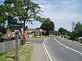
 Danehill village sign - geograph.org.uk - 2066791.jpg 480 × 640; 143 KB
-
 Danehill village.jpg 2,848 × 2,136; 2.5 MB
-
 Danehill.JPG 1,280 × 960; 574 KB
-
 Danehurst or St Raphael's care home - geograph.org.uk - 1608355.jpg 640 × 427; 159 KB
-

-

-
 Direction Sign - Signpost in Danehill - geograph.org.uk - 6102612.jpg 402 × 600; 284 KB
-
 Downhill towards Mill Brook - geograph.org.uk - 2060716.jpg 640 × 480; 188 KB
-
 Driveway at Stumblewood Common - geograph.org.uk - 5828344.jpg 1,024 × 678; 268 KB
-
 Driveway to Beaconwood Farm, near Chelwood Gate - geograph.org.uk - 5843216.jpg 1,024 × 768; 252 KB
-
 Driveway to Twyford Farm - geograph.org.uk - 5828383.jpg 1,024 × 647; 230 KB
-
 Ducks and Geese - geograph.org.uk - 2138201.jpg 640 × 480; 132 KB
-
 Dustbin day on Church Lane, Danehill - geograph.org.uk - 2068350.jpg 640 × 480; 202 KB
-
 Entrance to house near Moaps Farm - geograph.org.uk - 1342502.jpg 640 × 480; 118 KB
-

-
 Entrance to Tanyard Fishery on Tanyard Lane - geograph.org.uk - 3115013.jpg 3,264 × 2,448; 4.97 MB
-
 Eriskay on Twyford Lane - geograph.org.uk - 5828359.jpg 1,024 × 686; 156 KB
-
 Farm Building at Twyford Farm - geograph.org.uk - 5828392.jpg 1,024 × 610; 156 KB
-
 Farm building, Heaven Farm, Danehill - geograph.org.uk - 3371075.jpg 1,600 × 1,200; 430 KB
-
 Farm track to Chelwood Farm - geograph.org.uk - 2198599.jpg 3,264 × 2,448; 4.95 MB
-
 Field near April Cottage - geograph.org.uk - 2389316.jpg 1,600 × 1,200; 371 KB
-
 Field near Heaven Wood - geograph.org.uk - 2389513.jpg 1,600 × 896; 323 KB
-
 Field off Tanyard Lane - geograph.org.uk - 1981993.jpg 1,024 × 768; 347 KB
-
 Fields beside the woodland - geograph.org.uk - 5826199.jpg 1,024 × 675; 256 KB
-
 Fields by Ashdown Llama Park - geograph.org.uk - 2959413.jpg 640 × 480; 68 KB
-
 Fields by London Road, Danehill - geograph.org.uk - 5256424.jpg 2,048 × 1,536; 1.5 MB
-
 Fields by Millbrook Hill - geograph.org.uk - 2599868.jpg 1,594 × 1,156; 309 KB
-
 Fir trees in Ashdown Forest - geograph.org.uk - 2062893.jpg 640 × 480; 162 KB
-
 Fishing in Sheffield Forest - geograph.org.uk - 2138208.jpg 640 × 480; 125 KB
-
 Fishing Pond - geograph.org.uk - 4253755.jpg 640 × 480; 103 KB
-
 Flowering gorse on Ashdown Forest - geograph.org.uk - 4902859.jpg 4,608 × 3,456; 3.33 MB
-
 Folly Bridge at Chelwood Vachery Forest Garden - geograph.org.uk - 5308364.jpg 4,000 × 3,000; 4.58 MB
-
 Folly Bridge at Chelwood Vachery Forest Garden - geograph.org.uk - 5309346.jpg 4,000 × 3,000; 5.01 MB
-
 Folly Bridge at Chelwood Vachery Forest Garden - geograph.org.uk - 5309347.jpg 4,000 × 3,000; 4.69 MB
-
 Folly Bridge at Chelwood Vachery Forest Garden - geograph.org.uk - 5309353.jpg 4,000 × 3,000; 5.02 MB
-
 Footbridge across a small stream - geograph.org.uk - 5828340.jpg 1,024 × 684; 263 KB
-
 Footbridge at Stumblewood Common - geograph.org.uk - 5828333.jpg 1,024 × 693; 270 KB
-
 Footbridge in Ashdown Forest - geograph.org.uk - 5582413.jpg 1,024 × 685; 305 KB
-
 Footbridge in the forest - geograph.org.uk - 2062361.jpg 640 × 480; 212 KB
-
 Footbridge near Northland Farm - geograph.org.uk - 4595404.jpg 480 × 640; 128 KB
-
 Footbridge on the edge of woodland - geograph.org.uk - 5826214.jpg 1,024 × 701; 299 KB
-
 Footbridge on track near Danehill - geograph.org.uk - 2062483.jpg 480 × 640; 162 KB
-
 Footbridge over a bridleway - geograph.org.uk - 2062381.jpg 640 × 480; 219 KB
-
 Footbridge over Millbrook - geograph.org.uk - 2762574.jpg 4,000 × 3,000; 3.56 MB
-
 Footbridge over stream near Londonderry Farm - geograph.org.uk - 2757318.jpg 4,000 × 3,000; 3.52 MB
-
 Footpath and access lane joining Chelwood Corner - geograph.org.uk - 2198601.jpg 3,264 × 2,448; 5.57 MB
-
 Footpath approaching Perryman's Hill - geograph.org.uk - 2198262.jpg 3,264 × 2,448; 5.93 MB
-
 Footpath branches on track to Allin's Farm - geograph.org.uk - 2198265.jpg 3,264 × 2,448; 6.08 MB
-
 Footpath by Raven Wood - geograph.org.uk - 5582527.jpg 954 × 1,024; 450 KB
-
 Footpath from Horsted Lane - geograph.org.uk - 5406635.jpg 800 × 600; 214 KB
-
 Footpath from Tanyard Lane - geograph.org.uk - 1981970.jpg 1,024 × 768; 336 KB
-
 Footpath leaves Freshfield Lane - geograph.org.uk - 5343502.jpg 800 × 600; 259 KB
-
 Footpath near Tanyard Fishery - geograph.org.uk - 5778284.jpg 1,600 × 1,015; 597 KB
-
 Ford and footbridge over a brook - geograph.org.uk - 2062376.jpg 640 × 480; 202 KB
-
 Ford on Twyford Lane, in Ashdown Forest - geograph.org.uk - 5842468.jpg 1,024 × 768; 289 KB
-
 Forest Farm - geograph.org.uk - 1981935.jpg 1,024 × 768; 229 KB
-
 Forest Track in Ashdown Forest - geograph.org.uk - 5826241.jpg 1,024 × 656; 251 KB
-
 Forest track near Braberry Pond - geograph.org.uk - 2062468.jpg 640 × 480; 194 KB
-
 Forest track, Ashdown Forest - geograph.org.uk - 2060712.jpg 640 × 480; 201 KB
-
 Forestry machinery Press Ridge Warren - geograph.org.uk - 2130679.jpg 2,592 × 1,944; 2.1 MB


_-_geograph.org.uk_-_4980629.jpg)
_-_geograph.org.uk_-_4980630.jpg)


_-_geograph.org.uk_-_4980639.jpg)
_-_geograph.org.uk_-_4980643.jpg)
_-_geograph.org.uk_-_4980648.jpg)
_-_geograph.org.uk_-_4980649.jpg)
_-_geograph.org.uk_-_4981306.jpg)
_-_geograph.org.uk_-_4980652.jpg)
_-_geograph.org.uk_-_4980653.jpg)
_-_geograph.org.uk_-_4980654.jpg)
_-_geograph.org.uk_-_4981299.jpg)
_-_geograph.org.uk_-_4981309.jpg)
_-_geograph.org.uk_-_4981316.jpg)
_-_geograph.org.uk_-_4981331.jpg)
_-_geograph.org.uk_-_4981344.jpg)
_-_geograph.org.uk_-_4981365.jpg)

_-_geograph.org.uk_-_4980690.jpg)
_-_geograph.org.uk_-_4980692.jpg)
_-_geograph.org.uk_-_4980693.jpg)
_-_geograph.org.uk_-_4980696.jpg)
_-_geograph.org.uk_-_4980697.jpg)
_-_geograph.org.uk_-_4980698.jpg)
_-_geograph.org.uk_-_4980699.jpg)
_-_geograph.org.uk_-_4980702.jpg)
_-_geograph.org.uk_-_4980704.jpg)


